


Description
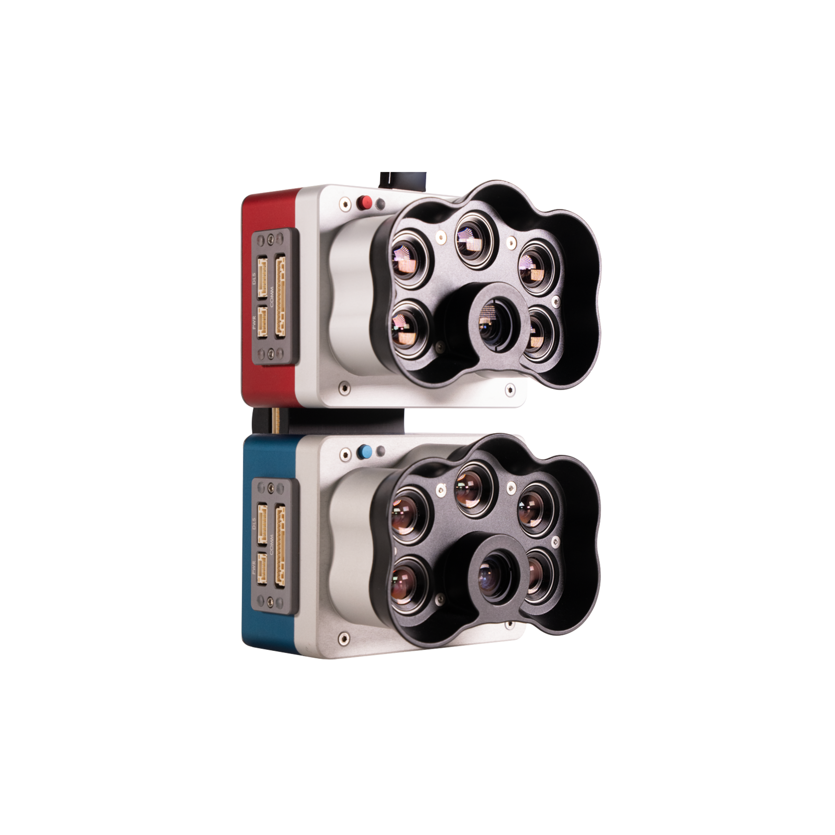
Kit multispectral MicaSense RedEdge-P (rouge et bleu) avec double monture et monture M300
10 bandes spectrales pour une comparaison améliorée des données avec les satellites
Capteur de drone composite multispectral et RVB haute résolution pour l'analyse de la végétation des plans d'eau, la classification des plantes, l'identification des mauvaises herbes, la recherche environnementale et la conservation.
La solution double comprend les caméras RedEdge-P et les nouvelles caméras bleues RedEdge-P.
Conforme à la NDAA.
CARACTÉRISTIQUES PRINCIPALES
DIX BANDES MULTISPECTRALES
Les bandes doubles RedEdge-P couvrent les bandes satellites Landsat 8 et Sentinel-2 avec une résolution spatiale améliorée.

BANDE PANCHROMATIQUE POUR UNE RÉSOLUTION AMÉLIORÉE
Le RedEdge-P dual permet un GSD de 2 cm par pixel / 0,8 pouce par pixel lors d'un vol à 60 m / 200 pieds. Des images plus nettes vous permettent de repérer les petits problèmes plus tôt et de prendre des décisions fiables.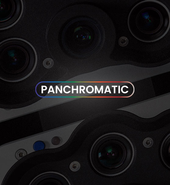
BANDE BLEUE CÔTIÈRE
La bande bleue côtière unique double RedEdge-P est spécialement conçue pour l'analyse de la végétation aquatique et l'identification des mauvaises herbes dans les environnements d'eau peu profonde.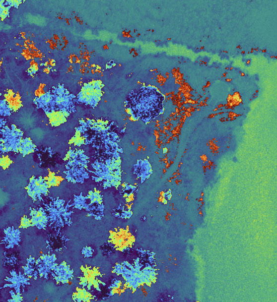 BANDES ÉTROITES
Les bandes spectrales étroites sont essentielles pour détecter les variations subtiles de la santé des plantes et permettent d'obtenir des données plus précises. Le RedEdge-P dual est un capteur à bande étroite qui capture les segments les plus pertinents de la courbe spectrale.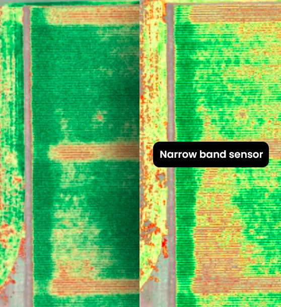 DOUBLE ÉTALONNAGE
Le capteur de lumière DLS et le panneau de réflectance CRP sont uniques sur le marché et permettent d'obtenir des données précises et fiables dans des conditions d'éclairage variables, permettant ainsi l'analyse de séries chronologiques.
OBTURATEUR GLOBAL
Sur les 10 objectifs, il résiste aux vibrations sans dégrader la qualité d'image. L'obturateur global du double RedEdge-P permet des prises de vue sans distorsion.
JUSQU'À 3 IMAGES/SECONDE
La carte CFexpress de 128 Go de stockage permet jusqu'à trois captures par seconde et un délai d'exécution immédiat entre les vols en échangeant les cartes.
CAPTURE SYNCHRONISÉE
Capture synchronisée des 10 bandes, déclenchement automatique et géolocalisation des images pour des temps de vol efficaces et un post-traitement facile.
CORRÉLATION DES DONNÉES DE DRONE ET DE SATELLITE
Les bandes doubles RedEdge-P couvrent les bandes satellites Landsat 8 et Sentinel-2 (~10 m / 32 pi par pixel) à une résolution spatiale améliorée de 2 cm / 0,8 po. Il permet l'utilisation de nombreux indices déjà créés à l'aide de satellites.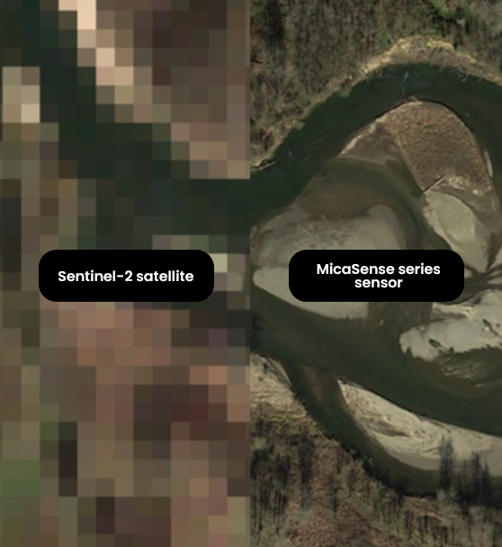 EFFECTUER UNE ANALYSE DE SÉRIES CHRONOLOGIQUES
Le kit multispectral double RedEdge-P est équipé d'un panneau de réflectance étalonné (CRP) et d'un capteur de lumière descendante (DLS). Ces outils d'étalonnage radiométrique tiennent compte des différentes conditions météorologiques et lumineuses, fournissant des données permettant une analyse fiable des séries chronologiques et la comparabilité des résultats dans le temps. 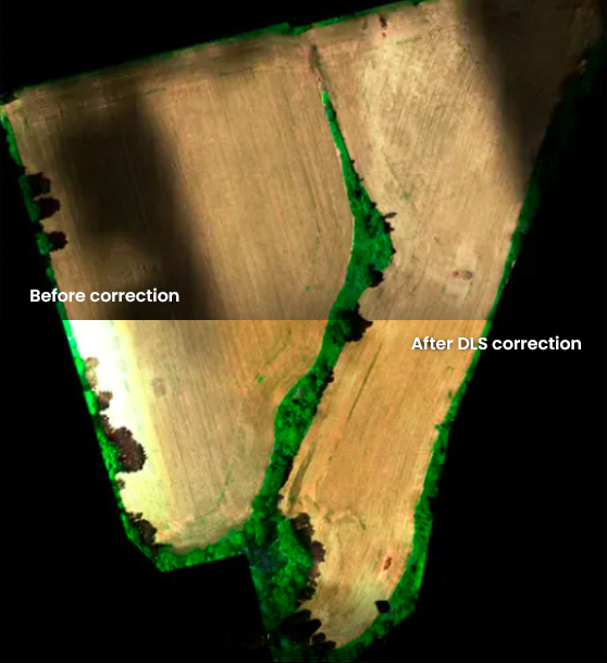 EXÉCUTER DES APPLICATIONS D'IA
La bande panchromatique du RedEdge-P dual permet une imagerie RVB et multispectrale haute résolution pour les applications d'apprentissage automatique, telles que le comptage des cultures à un stade précoce. 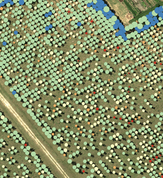 COMPATIBLE AVEC UNE LARGE GAMME DE LOGICIELS
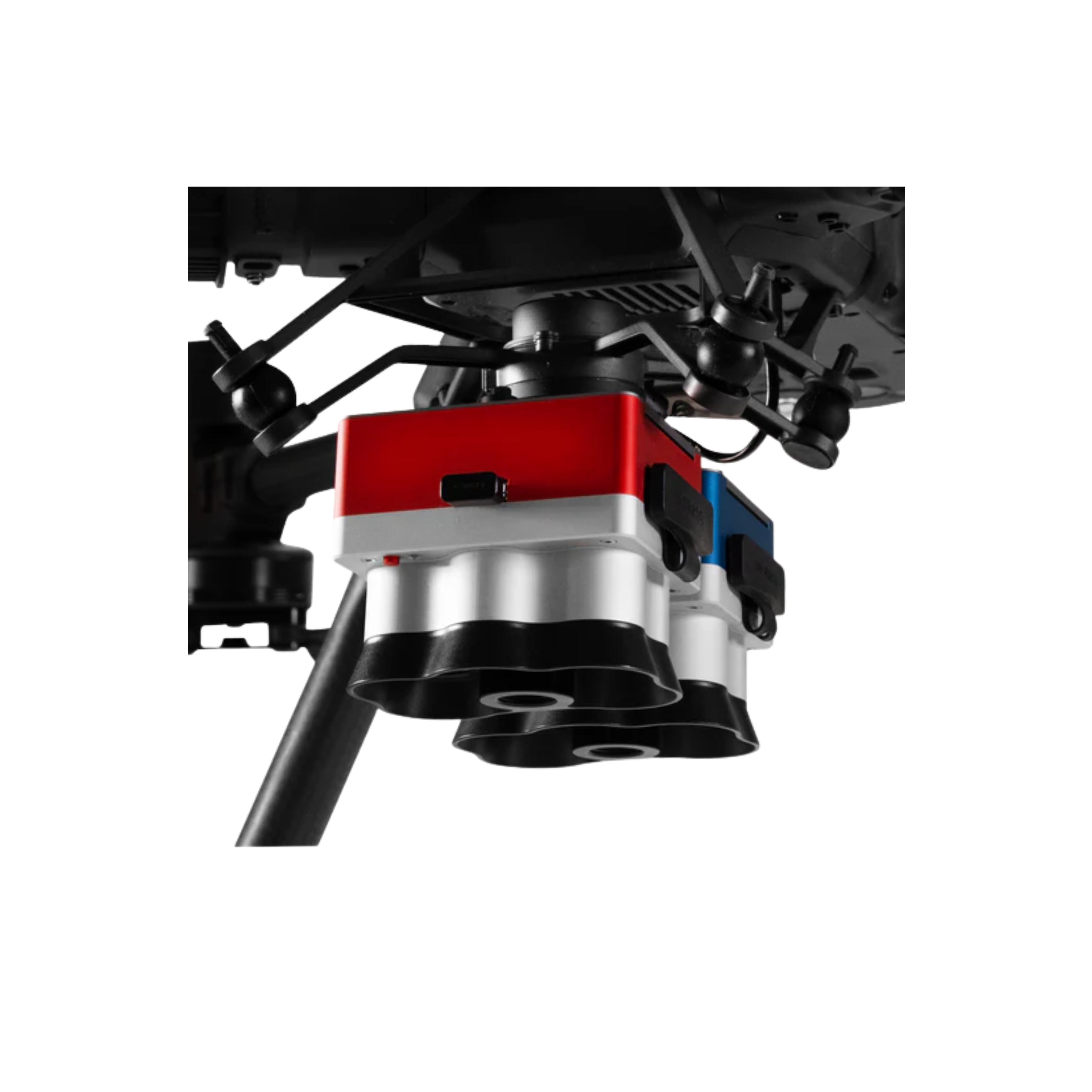
La caméra double RedEdge-P est compatible avec les drones DJI Matrice 350 RTK et DeltaQuad Evo. Elle dispose d'une interface API ouverte pour une intégration facile avec la plupart des logiciels de planification de vol et de post-traitement. OBTENEZ DES INFORMATIONS INVISIBLES À L'ŒIL NU
Capture simultanée de toutes les bandes, permettant plusieurs sorties et index haute résolution, tels que RVB, NDVI, NDRE, OSAVI, NIT, CIR, DSM et plus encore.
EFFECTUER UNE ANALYSE DÉTAILLÉE
- Analyse de la végétation des plans d'eau
- Surveillance environnementale
- Gestion de l'eau
- Surveillance, protection et restauration des habitats
- Identification des espèces végétales et des mauvaises herbes
CONTENU DU KIT
- Caméra RedEdge-P
- Caméra RedEdge-P bleue
- Support double pour DJI
- DLS2
- Mallette de transport Pelican
- CRP2
- Accessoires de montage pour Matrice 300
Caractéristiques
Poids : 745 g / 26,2 oz (deux capteurs, matériel de montage, DLS2 et câble)
Dimensions : 13,2 cm x 8,8 cm x 9,67 cm / 5,1 po x 3,1 po x 3,5 po
Bandes spectrales : bleu côtier 444(28)*, bleu 475(32), vert 531(14)*, vert 560(27), rouge 650(16)*, rouge 668(14), bord rouge 705(10)*, bord rouge 717(12), proche infrarouge 740(18)*, proche infrarouge 842(57)
Sortie RVB : 5,1 MP** (obturateur global, aligné sur toutes les bandes)
Résolution du capteur : 1456 x 1088 (1,6 MP par bande multispectrale) 2464 x 2056 (bande panchromatique de 5,1 MP)
Distance d'échantillonnage au sol : 7,7 cm / 3 pouces par pixel (par bande multispectrale) à 120 m / ~400 pi AGL 3,98 cm / 1,5 pouce par pixel (bande panchromatique) à 120 m / ~400 pi AGL
Champ de vision : 50° HFOV x 38° VFOV (multispectral), 44° HFOV x 38° VFOV (panchromatique)
Taux de capture : jusqu'à 3 images par seconde au format DNG brut
Stockage : carte CFexpress
Interfaces : Trois GPIO configurables : sélectionnez l'entrée de déclenchement, l'entrée PPS, la sortie PPS et les signaux de haut de trame. Bouton virtuel hôte. Port USB 2.0 pour Wi-Fi. Série. Ethernet 10/100/1000.
Alimentation externe : 7,0 V - 25,2 V
Puissance d'entrée : 11/14,0/20 W (veille, moyenne, crête)
Chaleur : Ambiante sans flux d'air : 0-40 °C / 0-104 °F
Ambiante avec débit d'air > 0,5 mètre par seconde / > 1,1 mph : 0-50 °C / 0-122 °F
Indice de protection IP : IP4X
Paiement et sécurité
Vos informations de paiement sont gérées de manière sécurisée. Nous ne stockons ni ne pouvons récupérer votre numéro de carte bancaire.
NOS MARQUES PARTENAIRES


Nous sommes honorés d'avoir remporté des contrats avec Sourcewell et Canoe , améliorant ainsi l'efficacité des achats pour les organismes gouvernementaux, éducatifs et à but non lucratif en Amérique du Nord - Voir les détails
Tu pourrais aussi aimer
Vu récemment
FAQ
Oui, la livraison est GRATUITE partout au Canada pour les commandes de plus de 199 $. Pour les commandes de moins de 199 $, un tarif fixe de 25 $ est appliqué.
Le service de réparation est éligible à la livraison gratuite si la valeur de la commande est supérieure à 300 $.
Les délais de livraison dépendent de votre localisation et du mode de livraison choisi. Les délais de livraison estimés et les options de livraison sont indiqués au moment du paiement.
Si votre achat présente un défaut de fabrication, vous pouvez le retourner dans un délai déterminé, à condition qu'il soit inutilisé et dans son emballage d'origine. Nous ne prenons pas en charge les retours de pièces détachées.
En tant que distributeur agréé, nos produits bénéficient généralement d'une garantie fabricant couvrant les défauts de fabrication pendant une période déterminée. La durée et les conditions exactes peuvent varier selon le produit. Veuillez consulter la fiche produit pour plus d'informations.
Notre équipe d'assistance client est disponible pour vous aider en cas de problème technique ou de besoin de service. Contactez-nous simplement et nous vous guiderons dans la résolution de votre problème ou organiserons une intervention si nécessaire.
Oui, nous vous recommandons de consulter les consignes de sécurité fournies avec votre produit. De plus, assurez-vous de respecter la réglementation locale et les bonnes pratiques pour une utilisation sûre et appropriée.
Oui, nous proposons des précommandes pour certains produits à venir. La disponibilité des précommandes, les dates de sortie estimées et les offres exclusives sont indiquées sur les pages produits correspondantes.
Nous proposons des tarifs et une assistance spécifiques pour les clients professionnels ou les commandes groupées. Veuillez contacter notre équipe commerciale pour obtenir des devis personnalisés et des informations complémentaires.
Si vous avez encore des questions, vous pouvez nous contacter ci-dessous et nous vous répondrons dans les plus brefs délais.