Description
TerraModeler
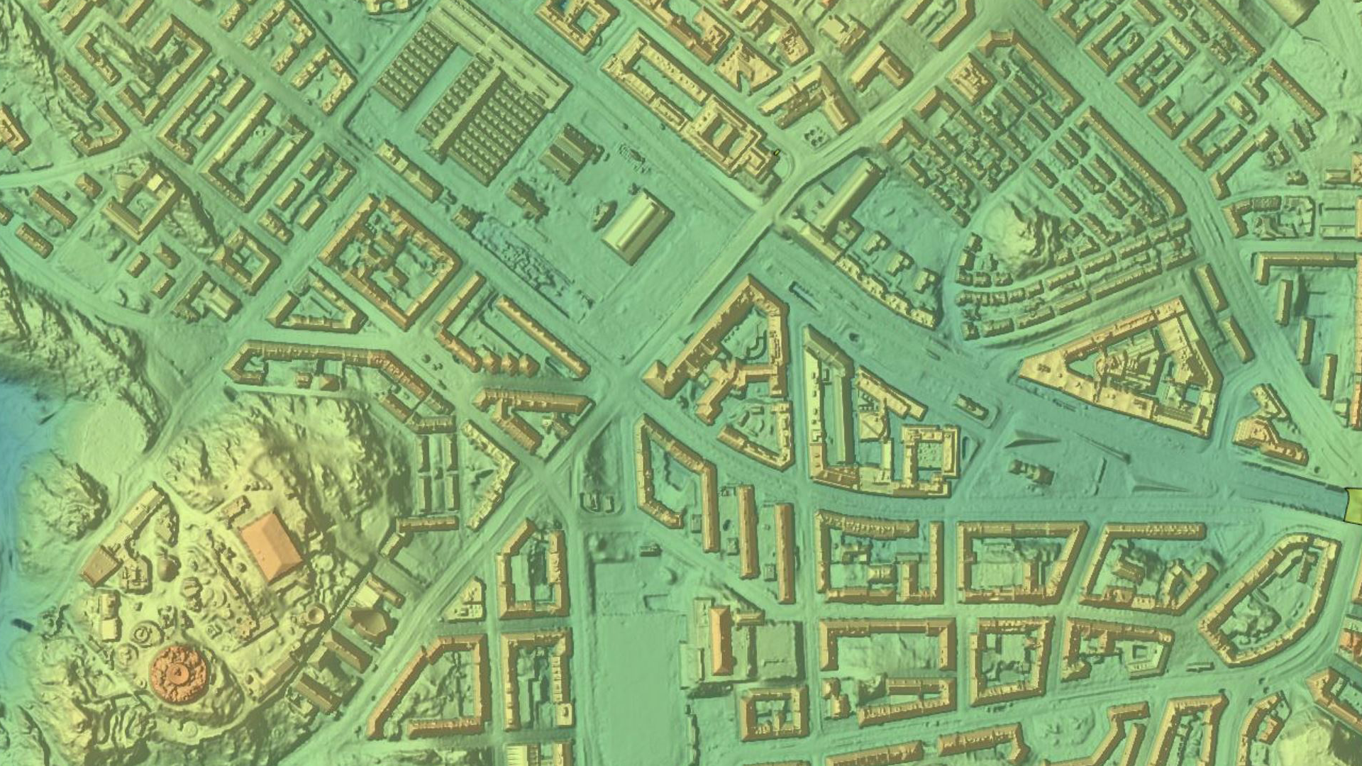
Avec TerraModeler, vous pouvez créer, modifier et utiliser des modèles de surface. TerraModeler crée des modèles de surface (TIN) à partir de diverses sources, telles que des points LiDAR stockés dans des fichiers binaires ou chargés dans TerraScan, des fichiers XYZ ascii et des éléments de conception graphique. Le logiciel offre des options de visualisation polyvalentes, notamment des surfaces ombrées colorées, des courbes de niveau, des grilles, des filets triangulaires colorés, des textes d'élévation, des directions de pente et des surfaces texturées (en combinaison avec TerraPhoto).
Les fonctionnalités supplémentaires comprennent la production de courbes de niveau et de modèles en treillis par lots, la modification du TIN, la création de profils, le calcul de volumes, le calcul des différences d'élévation ou de volume entre plusieurs modèles de surface, plusieurs options d'étiquetage ainsi que d'autres outils à des fins de conception. Complété par diverses options d'exportation, TerraModeler est un outil polyvalent pour de nombreux types de tâches de conception et de modélisation.
TerraModeler est disponible en versions Full, UAV et Lite
Matrice de fonctionnalités comparant TerraModeler, TerraModeler LITE et TerraModeler UAV
TerraModeler peut utiliser de nombreuses sources de surface différentes
Création de modèles de surface à partir de plusieurs sources, par exemple des points laser, des éléments de ligne de rupture, des fichiers texte xyz offrant les meilleurs résultats possibles pour l'analyse ou le produit final.
Réalisation de lignes de contour
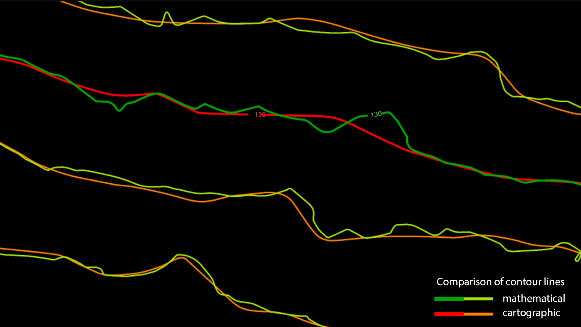
Les courbes de niveau sont la manière traditionnelle et familière de représenter les différences d'altitude sur une carte. Le LiDAR produit un nuage de points qui représente le sol et les objets qui s'y trouvent. Les points classés avec TerraScan peuvent être utilisés comme base pour la création de courbes de niveau dans TerraModeler. Le logiciel Terrasolid distingue deux types de courbes de niveau. Il existe des courbes de niveau mathématiques qui suivent très précisément les altitudes des points laser mais ne sont pas très utiles à des fins de cartographie et des courbes de niveau cartographiques qui sont lisses et esthétiques mais moins précises.
Applications
Urbanisme | Documentation et analyse architecturale et historique de sites | Intervention d'urgence, sécurité et défense | Analyse du bruit, des inondations, du soleil, de l'ombre, de la visibilité, de la foudre et du vent | Réalité virtuelle | Visualisation pour la communication d'informations aux citoyens | Propagation des ondes radio | Cartographie | etc.
Paiement et sécurité
Vos informations de paiement sont gérées de manière sécurisée. Nous ne stockons ni ne pouvons récupérer votre numéro de carte bancaire.
NOS MARQUES PARTENAIRES

Nous sommes honorés d'avoir remporté des contrats avec Sourcewell et Canoe , améliorant ainsi l'efficacité des achats pour les organismes gouvernementaux, éducatifs et à but non lucratif en Amérique du Nord - Voir les détails
Tu pourrais aussi aimer
Vu récemment
FAQ
Oui, la livraison est GRATUITE partout au Canada pour les commandes de plus de 199 $. Pour les commandes de moins de 199 $, un tarif fixe de 25 $ est appliqué.
Le service de réparation est éligible à la livraison gratuite si la valeur de la commande est supérieure à 300 $.
Les délais de livraison dépendent de votre localisation et du mode de livraison choisi. Les délais de livraison estimés et les options de livraison sont indiqués au moment du paiement.
Si votre achat présente un défaut de fabrication, vous pouvez le retourner dans un délai déterminé, à condition qu'il soit inutilisé et dans son emballage d'origine. Nous ne prenons pas en charge les retours de pièces détachées.
En tant que distributeur agréé, nos produits bénéficient généralement d'une garantie fabricant couvrant les défauts de fabrication pendant une période déterminée. La durée et les conditions exactes peuvent varier selon le produit. Veuillez consulter la fiche produit pour plus d'informations.
Notre équipe d'assistance client est disponible pour vous aider en cas de problème technique ou de besoin de service. Contactez-nous simplement et nous vous guiderons dans la résolution de votre problème ou organiserons une intervention si nécessaire.
Oui, nous vous recommandons de consulter les consignes de sécurité fournies avec votre produit. De plus, assurez-vous de respecter la réglementation locale et les bonnes pratiques pour une utilisation sûre et appropriée.
Oui, nous proposons des précommandes pour certains produits à venir. La disponibilité des précommandes, les dates de sortie estimées et les offres exclusives sont indiquées sur les pages produits correspondantes.
Nous proposons des tarifs et une assistance spécifiques pour les clients professionnels ou les commandes groupées. Veuillez contacter notre équipe commerciale pour obtenir des devis personnalisés et des informations complémentaires.
Si vous avez encore des questions, vous pouvez nous contacter ci-dessous et nous vous répondrons dans les plus brefs délais.


