


Description
Rent the DJI Mavic 3 Enterprise for your operations. Transport Canada Advanced Certificate required. Please contact us for a quote on rentals longer than 7 days.
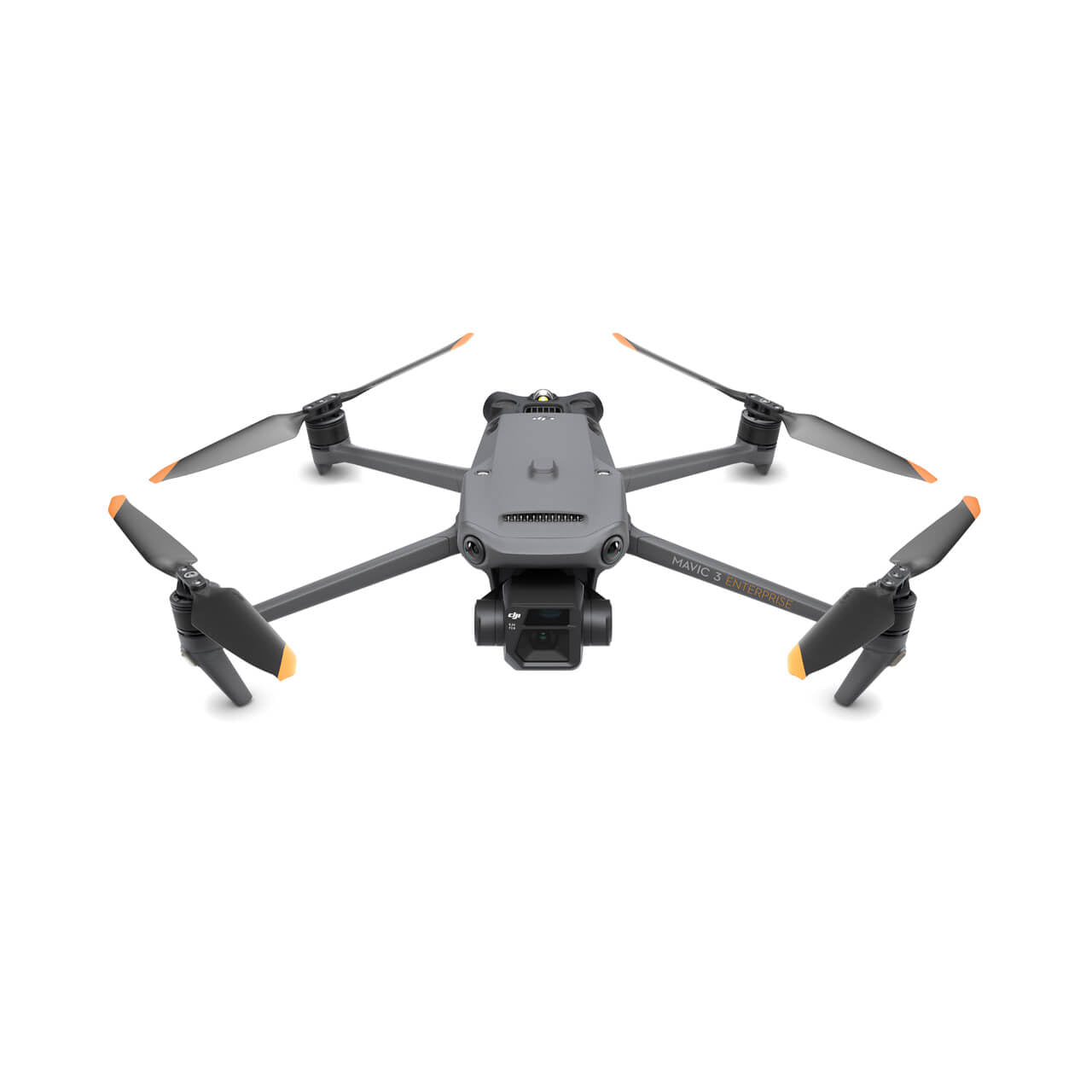
MAVIC 3E
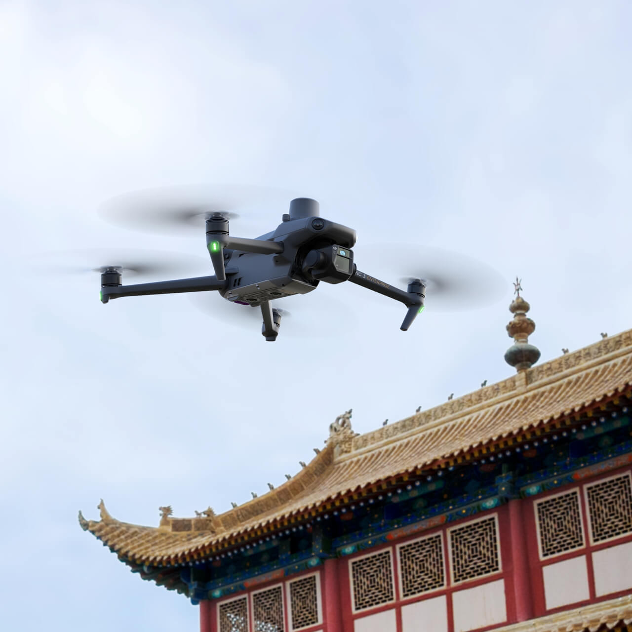
The Mavic 3E Series (including the DJI Mavic 3 Enterprise Thermal) redefines industry standards for small commercial drones. With a mechanical shutter, a 56× zoom camera, and an RTK module for centimeter-level precision, the Mavic 3E brings mapping and mission efficiency to new heights. A thermal version (the DJI Mavic 3 Enterprise Thermal) is available for firefighting, search and rescue, inspection, and night operations.

Compact and Portable
Streamlined and compact, Mavic 3E Series (including the DJI Mavic 3 Enterprise Thermal) can be carried in one hand and deployed at a moment's notice. Perfect for beginner and veteran pilots alike, it's built to perform on lengthy missions.
Wide
4/3 CMOS, 20MP, Mechanical Shutter
Tele
Equivalent Focal Length: 162mm, 12MP, 56× Hybrid Zoom
Survey with Speed
Mavic 3E's wide-angle 4/3 CMOS, 20MP sensor has a mechanical shutter to prevent motion blur and supports rapid 0.7-second interval shooting. Complete mapping missions with extraordinary efficiency without the need for Ground Control Points.
Improved Low-Light Performance
Mavic 3E's Wide camera has large 3.3μm pixels that, together with intelligent low-light mode, offer significantly improved performance in dim conditions.
Focus and Find
Both Mavic 3E and Mavic 3T are equipped with a 12MP Zoom Camera, supporting up to 56× Max Hybrid Zoom to see essential details from afar.
See the Unseen
Mavic 3T's thermal camera has 640 × 512 resolution and supports point and area temperature measurement, high-temperature alerts, color palettes, and isotherms to help you find your targets and make quick decisions.
Simultaneous Split-Screen Zoom
Mavic 3T's thermal and zoom cameras support 28× continuous side-by-side zoom for easy comparisons.
Batteries Optimized For Endurance
45-min flight durations let you cover more ground each mission, for surveying up to 2 square kilometers in a single flight.
Payment & Security
Your payment information is processed securely. We do not store credit card details nor have access to your credit card information.
OUR PARTNER BRANDS


We are honored to have been awarded Sourcewell and Canoe contracts, enhancing procurement efficiency for government, education, and non-profit agencies across North America - View Details
You may also like
Recently viewed
FAQs
Yes, we provide FREE shipping across Canada for orders over $199. Orders under $199 have a flat rate of $25.
Repair service is eligible for free shipping if order value is over $300.
Delivery times depend on your location and the selected shipping method. Estimated delivery times and shipping options are provided at checkout.
If there are any manufacturing defects with your purchase, you may return the product within a specified period, provided it is unused and in its original packaging. We do not provide any returns on repairs parts.
As an authorized distributor, our products typically come with a manufacturer's warranty that covers manufacturing defects for a specified period. The exact duration and terms may vary by product. Please refer to the product details for more information.
Our customer support team is available to assist you with any technical issues or service needs. You can simply reach out to us, and we'll guide you through troubleshooting steps or arrange for service if necessary.
Yes, we recommend reviewing the safety instructions provided with your product. Additionally, ensure compliance with local regulations and best practices to ensure safe and proper use.
Yes, we offer pre-orders for select upcoming products. Pre-order availability, estimated release dates, and any exclusive offers are listed on the respective product pages.
We offer special pricing and support for business customers or bulk orders. Please contact our sales team for customized quotes and additional information.
If you still have any questions, you can contact us below and we will get back to you as soon as possible.