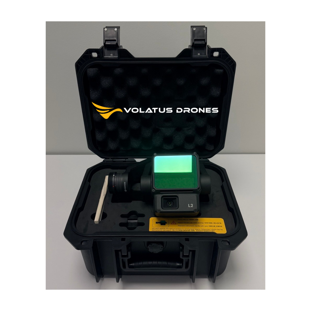
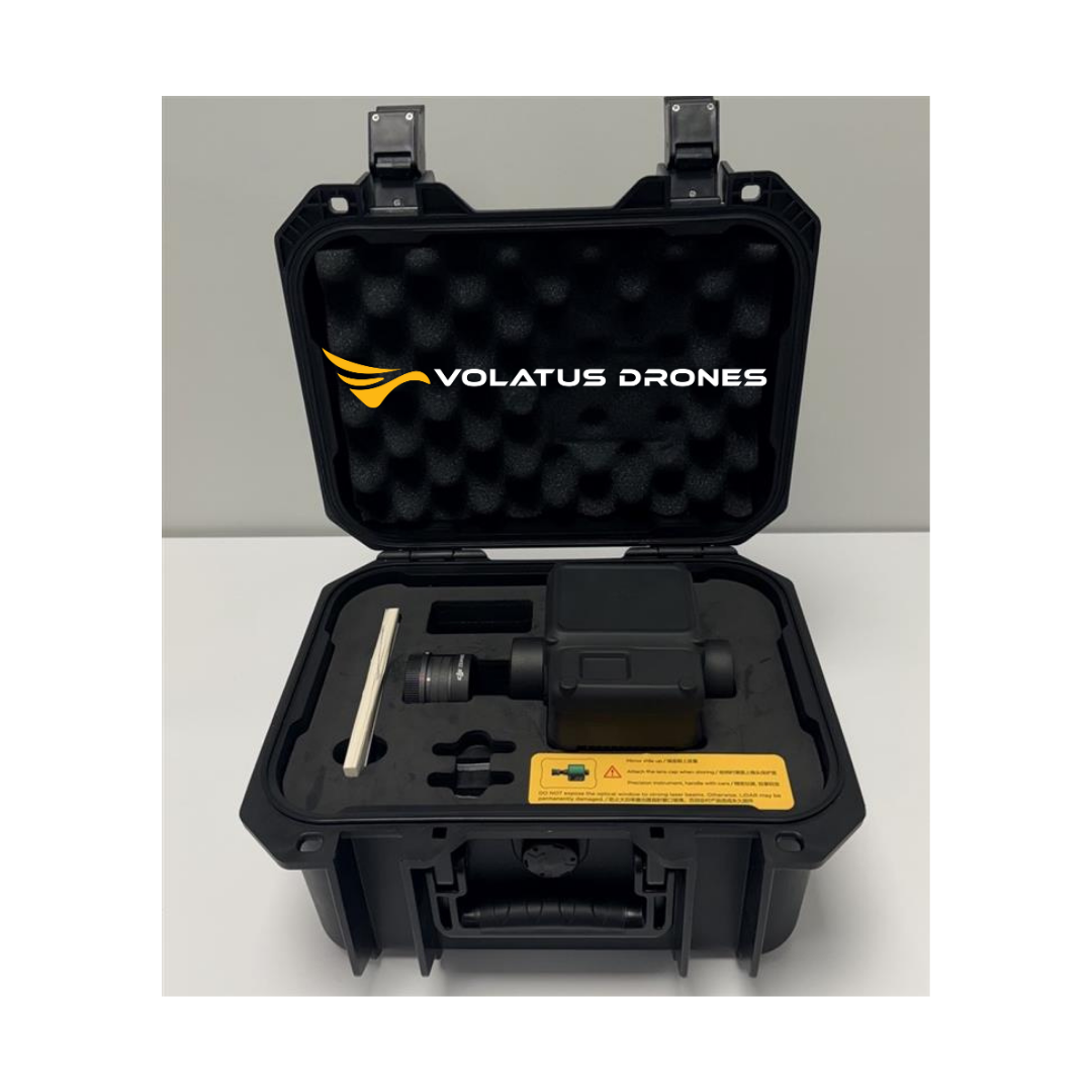


DJI Zenmuse L2 - Certified Pre-Owned
Item#: 9933
Certified Pre-Owned: This unit has gone through a rigorous 60-point inspection and has been certified to be in full working condition. All Certified Pre-Owned units are FINAL SALE.
INCLUDES:
- 1x DJI Zenmuse L2 - Certified Pre-Owned
- 1x Hard Case
The DJI Zenmuse L2 is a versatile airborne LiDAR payload designed for high-precision 3D mapping and surveying across multiple DJI drone platforms. It integrates a high-performance Livox LiDAR sensor, a 1-inch RGB camera, and DJI’s advanced gimbal stabilization technology into a lightweight, all-in-one solution.
Compatible with the DJI Matrice 400, Matrice 350 RTK, and Matrice 300 RTK (with DJI RC Plus), the Zenmuse L2 offers flexible mounting options to suit various operational needs. It delivers rapid data acquisition, dense point clouds, and high-resolution imagery for detailed spatial analysis and efficient mapping workflows. Rugged and intelligently integrated, the Zenmuse L2 empowers professionals in infrastructure inspection, forestry, mining, and other demanding applications to accelerate their data processing and decision-making with confidence.
Integrated LiDAR Solution
Supported by its powerful hardware, L2 can allow for a precise scan of complex subjects within an extended range and faster point cloud acquisition. During operations, users can preview, playback, and process point cloud models on-site, with Task Quality Reports generated by DJI Terra, offering a simple, one-stop solution to improve overall efficiency. This enables users to achieve high-precision point cloud results with one-stop post-processing.
30% Detection Range Increase
L2 can detect from 250 meters at 10% reflectivity and 100 klx, and up to 450 meters at 50% reflectivity and 0 klx. [3] The typical operational altitude now extends up to 120 meters, notably enhancing operational safety and efficiency.
Smaller Laser Spots, Denser Point Clouds
With a reduced spot size of 4×12 cm @100m, only a fifth of that of L1, L2 not only detects smaller objects with more details but can also penetrate denser vegetation, generating more accurate digital elevation models (DEM).
Supports 5 Returns
In densely vegetated areas, L2 can capture more ground points beneath the foliage.
Effective Point Cloud Rate: 240,000 pts/s
In both single and multiple return modes, L2 can reach a max point cloud emission rate of 240,000 points per second, allowing the acquisition of more point cloud data in a given time frame.
Live Point Cloud Viewing: Offering three viewing modes - RGB, pure point cloud, and a side-by-side display of point cloud and RGB data - you can swiftly preview the captured 3D point cloud model [4] for real-time progress monitoring.
Footnotes:
-
Evaluation conducted within a controlled DJI laboratory setting: The assessment took place with a Zenmuse L2 mounted on a Matrice 350 RTK and powered on. Flight route planning utilized DJI Pilot 2's Area Route function with IMU calibration enabled. The survey employed repetitive scanning in conjunction with the RTK in FIX status. A relative altitude of 150 meters, flight speed of 15 meters per second, gimbal pitch of -90°, and flight route segments under 1500 meters were maintained. The surveyed area featured objects with distinct angular characteristics, and reference points on solid ground adhered to the diffuse reflection model. Post-processing was carried out with DJI Terra, incorporating the optimization of point cloud accuracy. In the same conditions but with Point Cloud Accuracy Optimization disabled, vertical accuracy measured at 4 cm and horizontal accuracy at 8 cm.
-
Measured during Zenmuse L2's installation on Matrice 350 RTK, maintaining a flight speed of 15 m/s, a flight altitude of 150 meters, a side overlap rate of 20%, IMU calibration enabled, Elevation Optimization deactivated, and terrain follow turned off.
-
The provided data represents typical values. Measurement was performed using a flat target with dimensions larger than the laser beam diameter, an incident angle perpendicular to the target, and atmospheric visibility of 23 km. In low-light conditions, laser beams can achieve their optimal detection range. When a laser beam interacts with multiple targets, the total laser transmitter power is divided, resulting in a reduced achievable range. The maximum detection range reaches 500 meters.
-
The 3D model underwent sparse representation during the processing stage.
DJI Care Enterprise
In order to provide our users with a more comprehensive service solution, DJI has added support products for DJI Care Enterprise services, as follows:
|
DJI Care Enterprise(Zenmuse L2) |
|||
|
Product Name |
Basic |
Basic (2-Year Plan) |
Plus |
|
Service Period |
Validity Period: 1 year Renew Basic Plan up to twice |
Validity Period: 2 years Renew Basic Plan once |
Validity Period: 1 year Renew Plus Plan up to twice |
|
Covered Area |
the U.S., Canada, the UK, EU countries, Switzerland, Norway, Liechtenstein, Iceland, Serbia, Monaco, Australia, Japan, South Korea, and Mainland China. |
||
|
Service Content |
Water Damage Coverage; Free Two-Way Shipping |
||
|
• 2 low-Cost Replacements • DJI Care Express |
• 4 low-Cost Replacements • DJI Care Express |
• Unlimited free repair services within the coverage amount |
|
|
Purchasing and Binding
|
First activation and binding: DJI Care Enterprise (Basic/Basic 2-Year Plan/Plus) can be purchased if the product meets one of the following criteria: • Brand new and un-activate • Activated less than 72 hours (96 hours for Japan) • Less than 72 hours have passed after the DJI Enterprise device was repaired by an official DJI Service Center
Renew DJI Care Enterprise Basic/Plus can be purchased when the product meets all of the following criteria: • DJI Care Enterprise Basic or DJI Care Enterprise Basic (2-Year Plan) or DJI Care Enterprise Plus is purchased and the total purchased and bound service duration does not exceed 2 years • DJI Care Enterprise purchased has not yet expired or expired within 15 days |
||
Specifications
| Specifications | Details |
|---|---|
| Product Name | Zenmuse L2 |
| Dimensions | 155 × 128 × 176 mm (L×W×H) |
| Weight | 905 ± 5 g |
| Power Consumption | 28 W (typical), 58 W (max.) |
| IP Rating | IP54 |
| Supported Aircraft | Matrice 300 RTK (requires DJI RC Plus), Matrice 350 RTK |
| Storage Temperature | -20° to 60°C (-4° to 140°F) |
| Operating Temperature | -20° to 50°C (-4° to 122°F) |
| Detection Range | 450 m @ 50% reflectivity (0 klx); 250 m @ 10% reflectivity (100 klx); Max: 500 m |
| Point Cloud Rate | Single: max. 240,000 pts/s; Multiple: max. 1,200,000 pts/s |
| System Accuracy | Horizontal: 5 cm @ 150 m; Vertical: 4 cm @ 150 m |
| Point Cloud Coloring | Reflectivity, Height, Distance, RGB |
| Ranging Accuracy (RMS 1σ) | 2 cm @ 150 m |
| Max Returns Supported | 5 |
| Scanning Modes | Non-repetitive; Repetitive |
| FOV | Repetitive: H 70°, V 3°; Non-repetitive: H 70°, V 75° |
| Minimum Detection Range | 3 m |
| Laser Beam Divergence | H: 0.2 mrad; V: 0.6 mrad |
| Laser Wavelength | 905 nm |
| Laser Spot Size @100 m | H: 4 cm; V: 12 cm |
| Laser Pulse Emission Frequency | 240 kHz |
| Laser Safety | Class 1 (IEC 60825-1:2014) |
| Accessible Emission Limit (AEL) | 233.59 nJ |
| Reference Aperture | 23.85 mm (effective, circular) |
| Max Laser Pulse Power (5ns) | 46.718 W |
| IMU Update Frequency | 200 Hz |
| Accelerometer Range | ±6 g |
| Angular Velocity Meter Range | ±300 dps |
| Yaw Accuracy (RMS 1σ) | Real-time: 0.2°; Post-processing: 0.05° |
| Pitch/Roll Accuracy (RMS 1σ) | Real-time: 0.05°; Post-processing: 0.025° |
| Horizontal Positioning Accuracy | RTK FIX: 1 cm + 1 ppm |
| Vertical Positioning Accuracy | RTK FIX: 1.5 cm + 1 ppm |
| RGB Mapping Camera Sensor | 4/3 CMOS, Effective Pixels: 20 MP |
| Lens | FOV: 84°; Format: 24 mm; Aperture: f/2.8–f/11 |
| Focus Points | 1 m to ∞ (autofocus) |
| Shutter Speed | Mechanical: 2–1/2000 s; Electronic: 2–1/8000 s |
| Shutter Count | 200,000 |
| Photo Size | 5280 × 3956 (4:3) |
| Still Photography Modes | Single, Timed (20 MP); Timed Interval JPEG: 0.7–60 s; RAW/JPEG+RAW: 2–60 s |
| Video Codec and Resolution | H.264/H.265; 4K: 3840×2160@30fps; FHD: 1920×1080@30fps |
| ISO | Photo/Video: 100–6400 |
| Video Bitrate | 4K: 85 Mbps; FHD: 30 Mbps |
| Supported File System | exFAT |
| Photo Format | JPEG/DNG (RAW) |
| Video Format | MP4 (H.264/HEVC) |
| Gimbal System | 3-axis (tilt, roll, pan), Angular Vibration Range: 0.01° |
| Mounting | Detachable DJI SKYPORT |
| Mechanical Range | Tilt: -143° to +43°; Pan: ±105° |
| Controllable Range | Tilt: -120° to +30°; Pan: ±90° |
| Operation Mode | Follow/Free/Re-center |
| Data Storage | Raw: Photo/IMU/Point cloud/GNSS/Calibration files; Real-time point cloud modeling |
| Supported microSD Cards | UHS-I Speed Grade 3, 50 MB/s+; Max: 256 GB (See recommended models) |
| Recommended microSD Cards | Lexar 1066x U3 A2 V30 64/128/256GB, Kingston Canvas Go! Plus 128GB U3 A2 V30 |
| Post-Processing Software | DJI Terra; Cloud export formats: PNTS/LAS/PLY/PCD/S3MB |