
Hovermap ST’s tough, lightweight, IP65 weather-sealed design enables the capture of valuable data in previously inaccessible areas.This powerful combination of precision engineering, world-leading SLAM algorithms, and robust drone autonomy capability provides accurate LiDAR mapping for as-builts, surveys, or inspections.Equally capable above ground or underground, indoors or out, Hovermap ST can easily be switched from a handheld scanner or mounted to a drone, vehicle, backpack, or pole – providing the versatility needed to capture data anywhere.
3D DATA CAPTURE
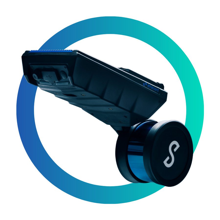
Compact Design
The compact, lightweight design makes it easy to carry for walking scans and provides a longer flight time when used on a drone.Weather Sealed
The tough, IP65, weather-sealed design allows the mapping of harsh environments without concern for dust, rain, extreme temperatures, or humidity.Explore beyond line of sight
The Tap-to-Fly autonomy feature enables mapping in previously inaccessible areas beyond line of sight and communication range. The omnidirectional Collision Avoidance, Guided Exploration, and smart Return-to-Home functions ensure Hovermap ST keeps a safe distance from assets and returns home safely with the valuable data it has collected.
Survey Grade Control
With Hovermap ST’s precision engineering, world-class SLAM (Simultaneous Localization and Mapping), and Emesent’s Automated Ground Control feature, you can capture dense, shadowless survey grade point clouds.
UNRIVALED SLAM ACCURACY WITH
AUTOMATED GROUND CONTROL
Together Hovermap ST and Automated Ground Control feature speeds up survey workflows and produce georeferenced, survey grade point clouds.Place Emesent Ground Control targets at surveyed locations in the environment prior to scanning.Conduct your non-stop scan. Unlike other SLAM control point solutions, there is no need to stop at each target or place Hovermap on the target.Emesent’s Ground Control targets are automatically detected by the processing software and used to remove SLAM drift and georeference the point cloud.Ground Control automatically detects the survey targets and applies a non-rigid transformation of the point cloud, giving you the most accurate results.In addition to improving accuracy for common mapping tasks, Hovermap ST with GCP can be used to create survey grade scans for long, linear assets, large or feature-poor environments that have previously been challenging for SLAM-based systems.
WHY CHOOSE HOVERMAP ST
SCAN THE INACCESSIBLE
Hovermap ST’s advanced autonomy enables flight and mapping in challenging situations, including beyond visual line of sight and communication range even in GPS-denied environments. Send a Hovermap ST enabled drone to explore and map previously inaccessible areas, providing new, valuable insights while you remain in a safe location.
SURVEY GRADE GEOREFERENCED POINTCLOUDS
Hovermap ST’s precision engineering, world-class SLAM (Simultaneous Localization and Mapping), and Automated Ground Control feature provides dense, shadowless, survey-grade point clouds of an entire asset. Ground Control also automatically georeferences point clouds to survey control.
BUILT FOR HARSH CONDITIONS
The tough, weather sealed, IP65 rated unit is dust and splash resistant, allowing you to map in severe environments, rain or shine. It can operate in temperatures from -10 to 45°C (14 to 113 °F) as well as high humidity, making it ideal for use in underground mines and other harsh environments.
UNRIVALED VERSATILITY
The plug and play design and quick-release mechanism allow easy switching between modes. Use Hovermap as a handheld scanner; attached to a drone, vehicle, or pole; lowered in a cage; or mounted to a backpack to easily collect data anywhere. The compact, lightweight design makes it easy to carry and provides longer flight time.
OPTIONS FOR EVERY SCANNING NEED
AUTONOMY LEVELS
AUTONOMY LEVEL 0
MAPPING MODE
Mapping Mode offers fast, accurate, and high resolution mobile scanning of environments where drone autonomy is unnecessary. Hovermap ST’s quick-release mechanism allows you to easily switch from a drone to handheld scanning or a backpack-, vehicle-, or protective shaft scanning cage-mount for SLAM-based mobile mapping.
AUTONOMY LEVEL 1
PILOT ASSIST MODE
Pilot Assist Mode provides omni-directional Collision Avoidance, line of sight GPS-denied flight capability, and stability control, providing the confidence and stability for close, thorough inspections. It acts as a safety bubble for your drone, keeping the asset and your equipment safe.
AUTONOMY LEVEL 2
AUTONOMOUS WAYPOINTS
Autonomous Waypoint Mode provides beyond line of sight flight through Smart Waypoints and Guided Exploration. Simply tap on the map to set smart waypoints, and Hovermap ST takes care of the rest, navigating to the waypoints, mapping the area, and keeping itself and the drone safe from obstacles.
IP RATED FOR HARSH ENVIRONMENTS
The tough, IP65 weather sealed design allows the mapping of hazardous areas without concern for dust, rain, extreme temperatures, or humidity.
COLORIZATION
Add a new level of reality capture to your 3D point clouds with Hovermap’s colorization feature. The 3D point clouds from Hovermap can be augmented with true color, providing additional context for visualization and analysis. Colorization provides greater insights across a variety of applications, revealing previously hidden details in your critical infrastructure.