3D DATA CAPTURE
Scan Large Areas in Less Time
With a LiDAR sensing range of 300 m (984 ft), Hovermap ST-X allows flying higher and faster to extend your transect coverage and enable faster data capture over large areas. Fewer flights are needed to cover an area, reducing lost time with setup, pack down, and relocation, as well as time spent merging scans.
Exceptional vegetation penetration
Triple returns and a rotating LiDAR (not statically mounted) make Hovermap ST-X perfect for terrain or forestry scanning. The resulting point cloud is dense, making it easier to classify scanned objects.
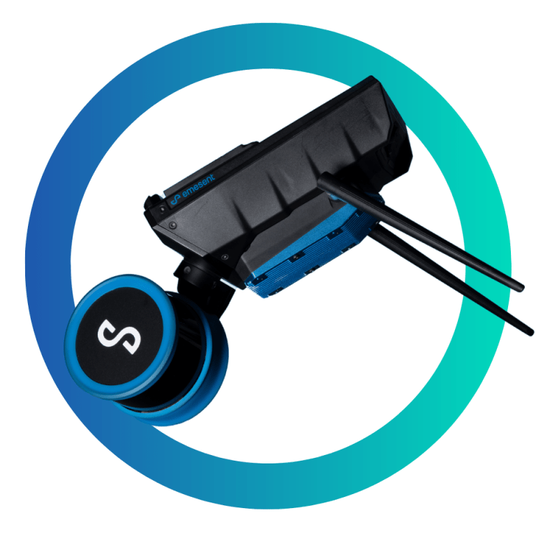
DURABLE. ADAPTABLE.
The tough, weather sealed Hovermap ST-X is dust and splash resistant, making it ideal for use in dusty or otherwise harsh environments. Extend its capability with the accessory port and mount points, and add Long Range Radio, Colorization hardware, or an inspection camera.
Survey Grade Scans
In addition to improving accuracy for common mapping tasks, Hovermap ST-X with GCP can be used to create survey grade scans for long, linear assets, large or feature-poor environments that have previously been challenging for SLAM-based systems.
WHY CHOOSE HOVERMAP ST-X
CAPTURE DETAILED, ACCURATE DATA
A LiDAR sensing range of 300 meters and triple returns that captures more than one million points per second allows you to capture detailed, accurate data over a great area in less time – giving you faster time to insight.
SUB-CENTIMETER INDOOR SCANS
The award-winning Wildcat SLAM solution, Automated Ground Control Points (optional), and improved LiDAR sensor accuracy provides a cleaner, more precise point cloud with 4 to 5 mm accuracy allowing you to obtain more accurate measurements and improved insights.
UNIQUELY VERSATILE
The plug and play design and quick-release mechanism allow easy switching between modes. Use Hovermap as a handheld scanner; attached to a drone, vehicle, or pole; lowered in a cage; or mounted to a backpack to easily collect data anywhere. The compact, lightweight design makes it easy to carry and provides longer flight time.
ROBUST, AUTONOMOUS CAPABILITY
Advanced autonomy and 360 degree Collision Avoidance enables flight and mapping in challenging surroundings, including beyond visual line of sight and communication range, even in GPS-denied environments – providing new, valuable insights while the operator remains in a safe location.
OPTIONS FOR EVERY SCANNING NEED
AUTONOMY LEVELS
AUTONOMY LEVEL 0
MAPPING MODE
Mapping Mode offers fast, accurate, and high resolution mobile scanning of environments where drone autonomy is unnecessary. Hovermap ST-X’s quick-release mechanism allows you to easily switch from a drone to handheld scanning or a backpack-, vehicle-, or protective shaft scanning cage-mount for SLAM-based mobile mapping.
AUTONOMY LEVEL 1
PILOT ASSIST MODE
Pilot Assist Mode provides omnidirectional Collision Avoidance, line of sight GPS-denied flight capability, and stability control, providing the confidence and stability for close, thorough inspections. It acts as a safety bubble for your drone, keeping the asset and your equipment safe.
AUTONOMY LEVEL 2
AUTONOMOUS WAYPOINTS
Autonomous Waypoint Mode provides beyond line of sight flight through Smart Waypoints and Guided Exploration. Simply tap on the map to set smart waypoints, and Hovermap ST-X takes care of the rest, navigating to the waypoints, mapping the area, and keeping itself and the drone safe from obstacles.
LONG RANGE RADIO
Easily attach Emesent’s Long Range Radio (optional) to Hovermap ST-X to increase the connectivity range up to 20 times. This allows viewing the live streamed point cloud and provides the benefits of safe, autonomous GPS-denied flight over longer distances.
COLORIZATION
Add a new level of reality capture to your 3D point clouds with Hovermap’s colorization feature.
The 3D point clouds from Hovermap can be augmented with true color, providing additional context for visualization and analysis. Colorization provides greater insights across a variety of applications, revealing previously hidden details in your critical infrastructure.
TAP - TO - FLY
AUTONOMY
With Autonomous Waypoint Mode (AL2), pilots can fly an entire mission, from takeoff to landing, using a tablet.
Hovermap ST-X’s Tap-to-Fly feature enables exploration in previously inaccessible areas beyond line of sight and communication range, accessing unprecedented insights. The omnidirectional Collision Avoidance, Guided Exploration, and smart Return-to-Home functions ensure assets are kept safe and valuable equipment doesn’t get damaged or lost.
Hovermap ST-X streams a live point cloud to the Hovermap app, providing a real-time preview of the data as it is captured when in communication range. Allowing you to leave the site confident you’ve captured everything you need.
Specifications
AUTONOMY
Tap-To-Fly and Guided Exploration
Waypoint setting in real time 3D map and autonomous path planning
LiDAR omnidirectional range of 1.2 to 40 m (3.9 to 131 ft),
Size of an obstacle > 2 mm wire (3/32 in)In-flight,
adjustable safety distance
Intelligent Return To Home
Autonomous Return To Home navigation triggered by low battery or excessive dust
Non-GPS flight, position hold, assisted flight, collision avoidance, regulated flight speed.
Mapping
0.5 to 300 m, 1.6 to 984 ft
Single Return Mode: up to 640,000 points/sec,
Multi Return Mode (3 return): up to 1,920,000 points/sec,
360 x 290° field of view,
Class 1 Eye Safe,
Full resolution point cloud, decimated point cloud, trajectory file.
Point cloud file formats: .las, .laz, .ply, .dxf, .E57
Simultaneous Localization and Mapping (SLAM)
± 15 mm (19/32 in) in general environments,
± 10 mm (3/8 in) in typical indoor and underground environments,
± 5 mm (7/32 in) isolated change detection capability
512 Gigabytes,
More than 4 hours of sensor data
Intensity, range, time, return number (strongest, first & last), ring number, RGB / true color (optional)
Physical
IP65 certification pending
DJI M300,
DJI M210v1,
Acecore Zoe
Internal
Hovermap ST-X Kit Includes
1x Emesent Data Processing Licence Key with Aura Lite Software
1x Hovermap ST-X
1x Hardcase for Hovermap
1x Battery
1x Handheld/Battery cable 1.5m (Fischer ST/STX to D-Tap Battery)
1x Drone/Battery cable 0.35m (Fischer to Fischer)
1x Cable Bag
1x Handle
1x Belt Clip
1x Standard Charger with 3 x international adaptor (US/Canada, AUS/NZ, Europe/Japan)
1x Hovermap Scanning Software USB
1x Quick Start Guide (printed)