
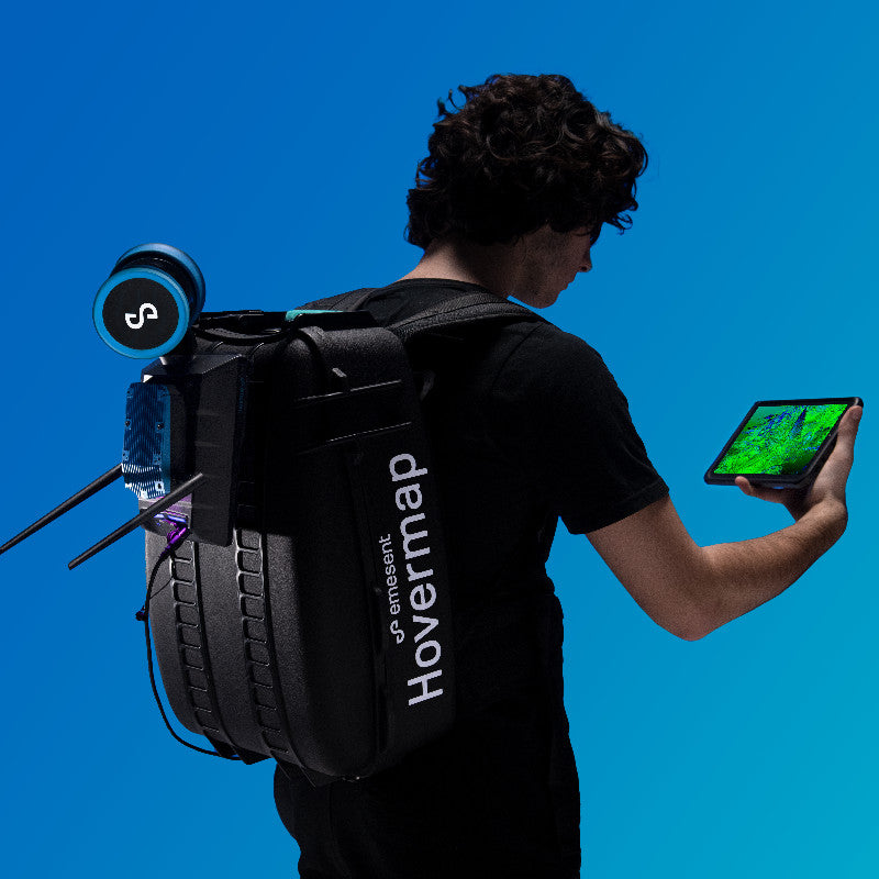


Description
Description
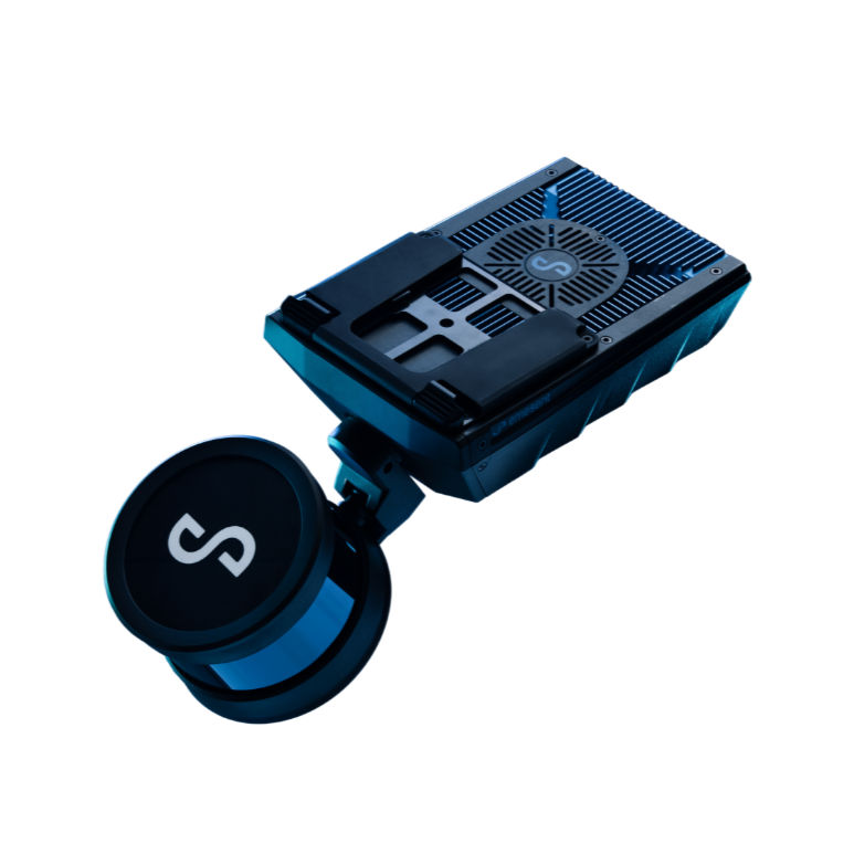
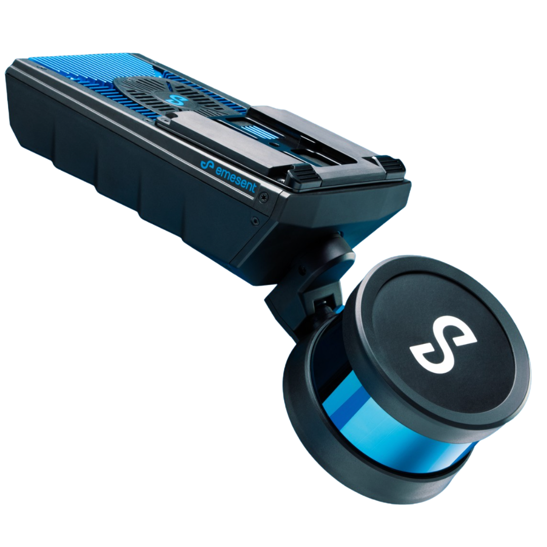
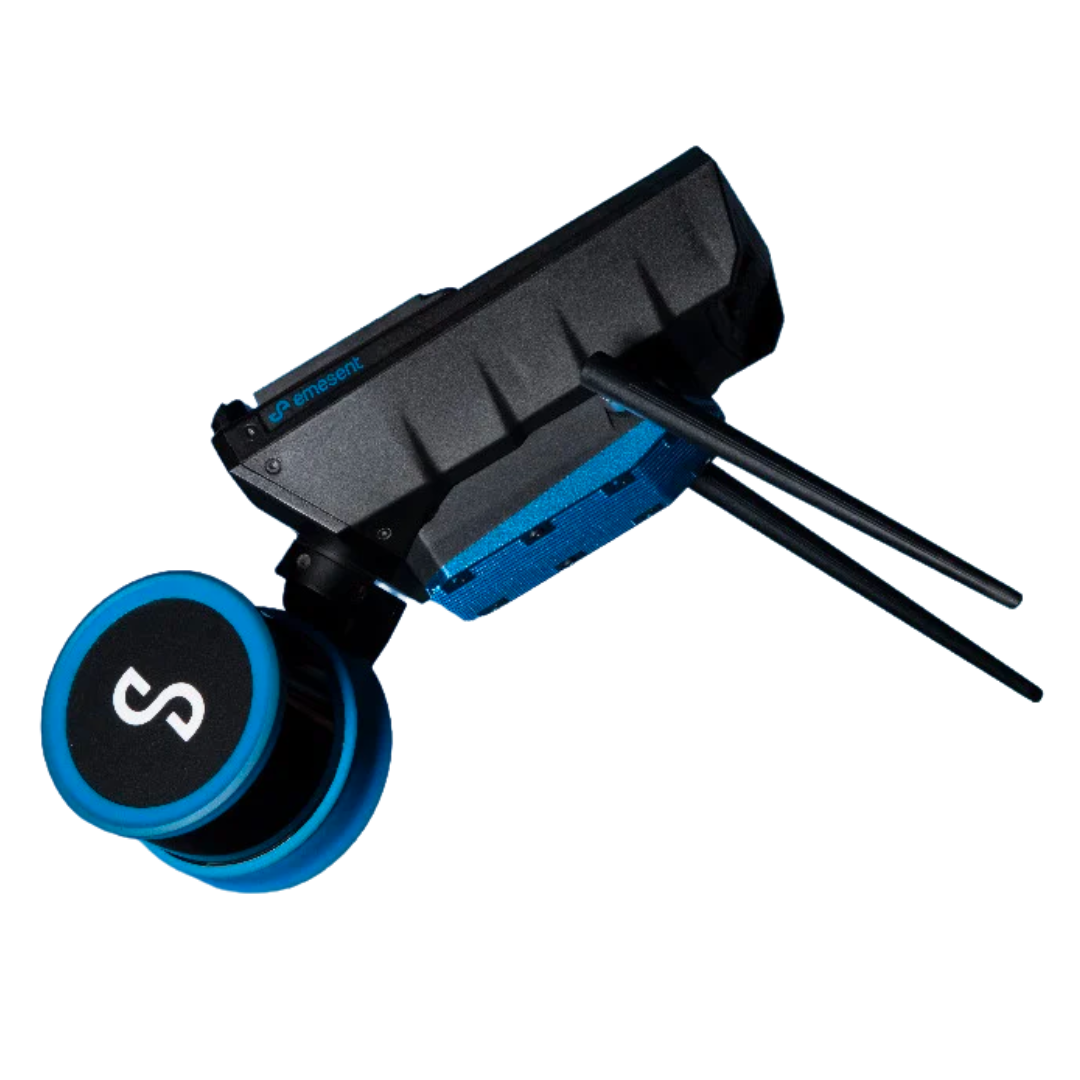
Autonomous & versatile, the slam-based mapper making data capture fast & simple

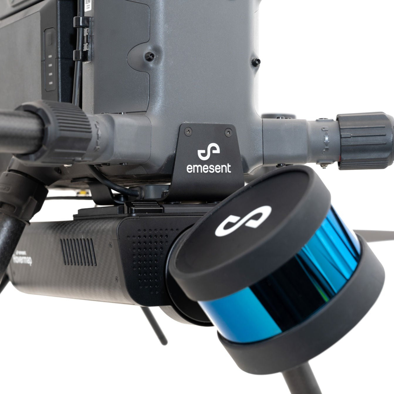
Collision avoidance
Hovermap acts as a virtual safety bubble around the drone to prevent collisions. LiDAR data is processed onboard in real-time to produce a local 3D map of the surroundings. Obstacles such as telecom towers, fences, trees, poles, wires and people can all be detected and avoided.
GPS-denied flight
Drones usually rely on GPS for localization, navigation and flight control. Hovermap uses LiDAR data and advanced algorithms onboard in real-time to provide reliable and accurate localization and navigation without the need for GPS. This allows drones to fly autonomously in GPS-denied environments, enabling a host of new applications such as flying and mapping in underground mines, inside warehouses or inspecting underneath bridges.
SLAM based 3D mapping
Hovermap uses Simultaneous Localization and Mapping (SLAM) algorithms enabling mobile mapping and autonomous drone flight even when GPS is unavailable. Using Emesent’s proprietary calibration and drone autonomy algorithms, it is built on CSIRO’s Wildcat SLAM Solution.
Autonomy
 |
 |
 |
|
Level 0 |
Level 1 |
Level 2 |
|
|
|
Key Features
- Rapid Scanning
- Collision Avoidance
- GPS-Denied Flight
- Slam-based 3D Mapping
Specifications
| LiDAR range | Up to 100 |
| LiDAR accuracy | +/- 3cm |
| Global SLAM accuracy | +/1 0.1% typical |
| Angular field of view |
360° x 360° |
|
Data acquisition speed |
300,000 points/sec |
|
File size |
~300MB/min |
| Flight speed |
Up to 5m/s (scene dependent) |
| Laser safety class |
Class 1 eye safe |
| Power |
Max. 90 W |
| Input voltage |
12 – 50 V (e.g. 4s LiPo) |
| Weight | 1.8 kg |
Autonomy Specifications
| Flight Modes |
Manual Pilot Assist |
| Autopilot Compatibility |
DJI A3 |
|
Collision Avoidance field of view |
360° x 360° |
|
GPS-denied flight |
Yes |
Commercial Financing Available
| 5.99% AOC | Up to 100% financing |
| 36 month term | Approved within 48 hours |
| No hidden fees | Cost treated as opex |
Payment & Security
Your payment information is processed securely. We do not store credit card details nor have access to your credit card information.
OUR PARTNER BRANDS


We are honored to have been awarded Sourcewell and Canoe contracts, enhancing procurement efficiency for government, education, and non-profit agencies across North America - View Details
You may also like
Recently viewed
FAQs
Yes, we provide FREE shipping across Canada for orders over $199. Orders under $199 have a flat rate of $25.
Repair service is eligible for free shipping if order value is over $300.
Delivery times depend on your location and the selected shipping method. Estimated delivery times and shipping options are provided at checkout.
If there are any manufacturing defects with your purchase, you may return the product within a specified period, provided it is unused and in its original packaging. We do not provide any returns on repairs parts.
As an authorized distributor, our products typically come with a manufacturer's warranty that covers manufacturing defects for a specified period. The exact duration and terms may vary by product. Please refer to the product details for more information.
Our customer support team is available to assist you with any technical issues or service needs. You can simply reach out to us, and we'll guide you through troubleshooting steps or arrange for service if necessary.
Yes, we recommend reviewing the safety instructions provided with your product. Additionally, ensure compliance with local regulations and best practices to ensure safe and proper use.
Yes, we offer pre-orders for select upcoming products. Pre-order availability, estimated release dates, and any exclusive offers are listed on the respective product pages.
We offer special pricing and support for business customers or bulk orders. Please contact our sales team for customized quotes and additional information.
If you still have any questions, you can contact us below and we will get back to you as soon as possible.